Remnants, Remainders, Continuities, and Ghosts
This installation is an assemblage of large-format inkjet and silkscreened prints, found objects, and bricks assembled into a multidimensional mapping of remnants, remainders, ghosts, and continuities present in urban space.
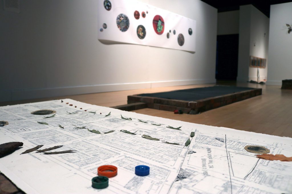
Upon walking into the gallery, viewers approach a map of Hollins Market resting on a structure composed of stacked bricks. The map was drawn by the Sanborn Map Company[1] in 1953. Lying over the map is a translucent layer of drafting paper, onto which I have drawn details concerning city development both prior to and following the date of the map’s creation. The combination of these layers creates a multi-temporal representation of the neighborhood and its surrounding area.
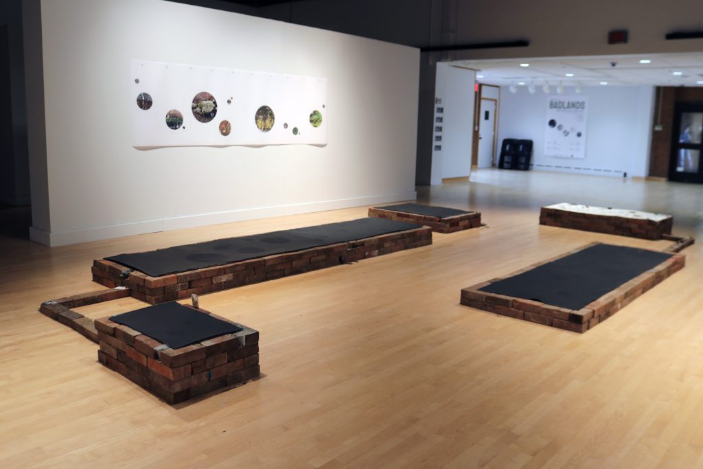
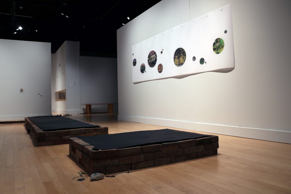
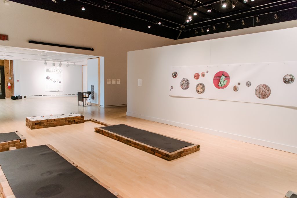
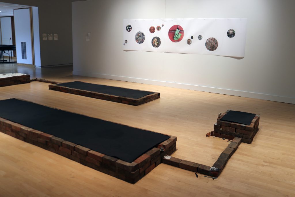
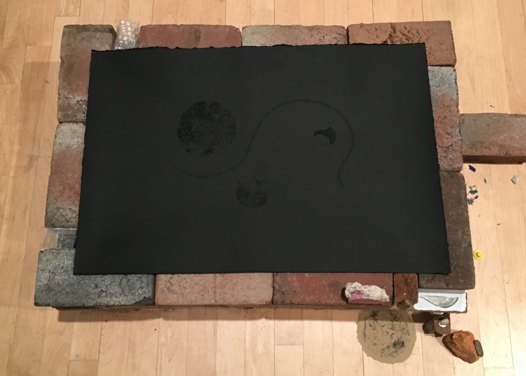
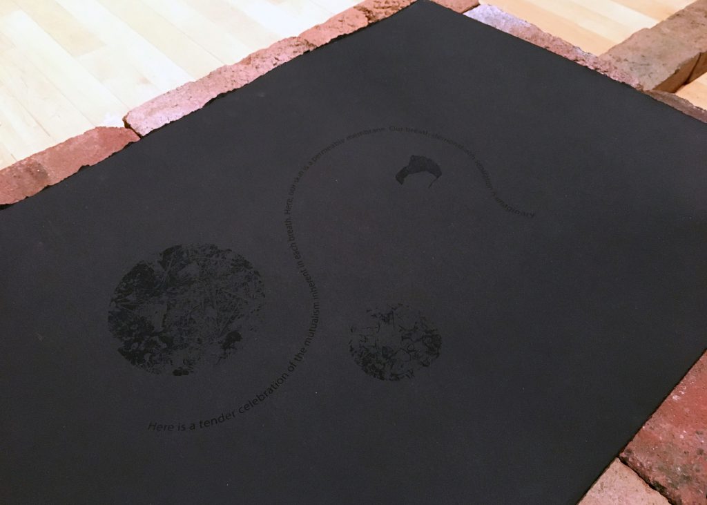
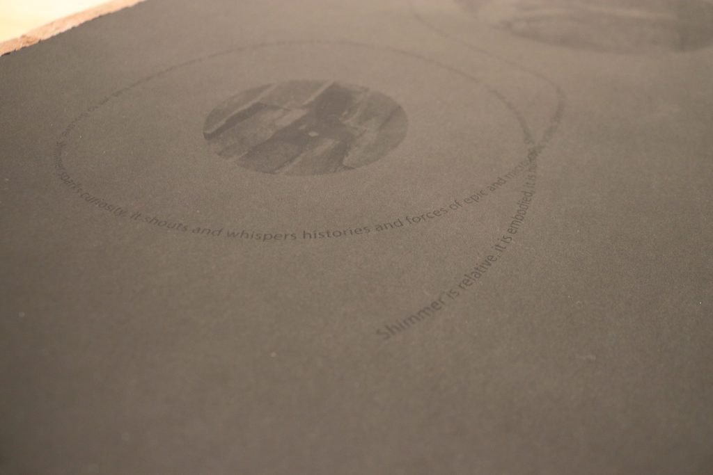
Behind the table, black screen prints on black paper lay on brick structures of varying heights. Each print features circular images of various sizes that document details of landscapes featured on the Sanborn map. The images represent micro-details from the four main sites of the tour: Boyd Street, Little Lithuania Park, Martin Luther King Jr. Boulevard between Baltimore and Lombard, and the intersection of Baltimore and Arlington Streets. The circular images are tied together with a singular line of curving text, which narrates sensations and observations of each site.
In order to see the work clearly, viewers must grapple with scale, relative distance, movement, and touch. The black ink is nearly invisible at certain angles; however, when viewers locate the proper angle, the prints glisten in full legibility. Bricks connect each structure together, simulating the grid of city blocks and determining gallery visitors’ travel paths, while the undulating curves of the text evoke a sense of organic wandering between angular structures.
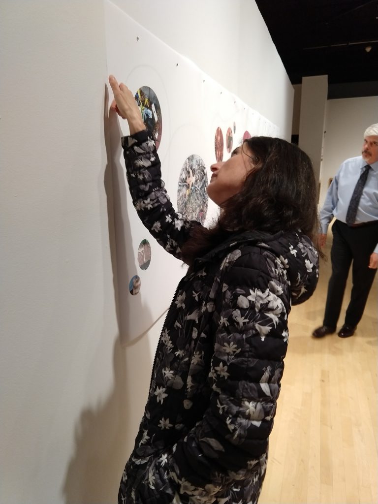
On the two walls on either side of the brick structures hang two layers of mylar paper. The top layer is printed with circular photographs, while a curving line of text is printed on the paper underneath, as if it were wandering between and around each of the photographs. From a distance, the text is visible, but not discernable. Viewers are invited to use a fingertip to lightly press the top layer down so that it touches the bottom layer, which reveals the text in full legibility.
The circular photographs vary in scale: large images require the viewer to stand at a distance to view them; small ones require intimate closeness. While each photograph documents tiny forms at each site, the circular shape of each photograph echoes representations of celestial bodies, shifting senses of scale to an even greater degree. By heightening the impact of reflection, movement, touch, and scale, the installation replicates and brings attention to the multi-sensory process by which details in landscape enter perception.
[1] Sanborn maps of Baltimore (1867 – 1970) are available online through the Enoch Pratt Free Library. While they were first drafted for insurance companies to assess fire liability, their detailed recollection of the various iterations of over 12,000 American cities is invaluable to historians, artists, and other researchers.